Toronto has quietly become one of the best cities for running in North America. With 600+ km of trails, a stunning waterfront, ravines that make you forget you're in a major city, and car-free islands a short ferry ride away — the 6ix offers something for every runner. We built the Crewa running app to help Toronto runners find partners for these routes — and this guide is our love letter to the city's best paths.
This guide covers 13 essential Toronto running routes — including three standouts: the Toronto Islands, Scarborough Bluffs, and Moore Park Ravine. Whether you're training for the Toronto Marathon or just looking for a new after-work route, we've got you covered.
🏃 Looking for running partners at your pace? The Crewa running app matches you with small local crews based on pace, schedule, and neighborhood.
Try Crewa Free →📚 New to Running in Toronto?
This guide focuses on routes. For run clubs, races, warm-up drills, and safety tips, see our Ultimate Guide to Running in Toronto. For cold-weather training, check the Toronto Winter Running Guide.
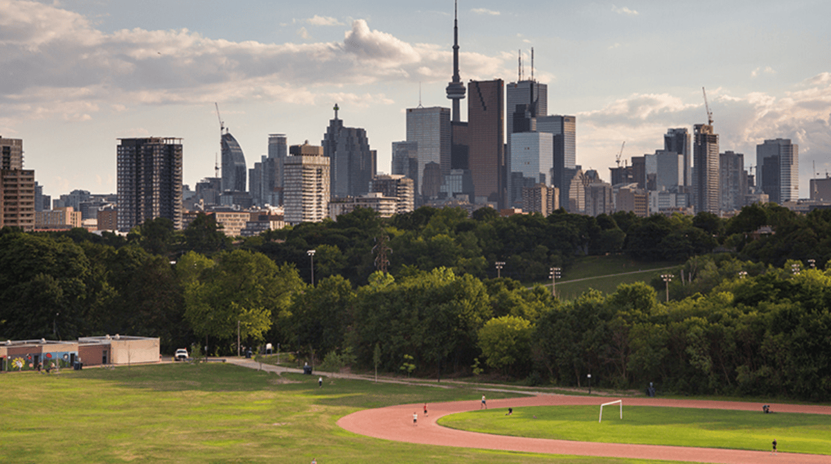
Martin Goodman Trail — The Waterfront Classic
EasyThe best running route in Toronto for beginners and long-distance runners alike. Stretching along Lake Ontario from Humber Bay to Rouge River, this is the backbone of Toronto running.
The most popular section — Harbourfront to the Beaches — is about 10K of flat, smooth pavement with skyline views. It's plowed in winter, making it one of the most reliable year-round routes.
📖 Did You Know?
The trail is named after Martin Goodman, a former Toronto Star editor-in-chief who was an avid cyclist. When he passed away in 1981, his colleagues raised funds to create this waterfront path. It opened in 1984.
Local Tips
- Beat the crowds: Go before 8am on weekends or after 7pm on weekdays
- Best beginner section: Start at Harbourfront, run east to Cherry Beach and back (10K)
- Winter tip: The section near Ontario Place is cleared first after snow
- Washrooms: Sunnyside Pavilion, Harbourfront Centre, Woodbine Beach
🏃 Popular Strava Segment
"Harbourfront to Cherry Beach" — 5.2km, flat. One of the most-run segments in Toronto. CR is under 16 minutes.
High Park — Best Hill Training in Toronto
ModerateThe best hill training location in Toronto. At 400 acres, it's the city's largest public park — with paved roads for steady runs, dirt trails for variety, and enough hills to humble anyone.
The main perimeter loop is about 5K. It's also the most popular meetup spot for Toronto run clubs.
🏔️ The Spring Road Hill
The "Spring Road Hill" near the zoo is Toronto's favorite for hill repeats — steep enough to burn, short enough to recover. Do 6-10 reps. Just avoid cherry blossom weekend unless you want an audience of 100,000.
Toronto Islands — Car-Free Urban Escape
EasyJust a 15-minute ferry ride from downtown, the Toronto Islands offer the most unique running experience in the city. Zero cars, stunning skyline views, beaches, and almost 14 km of paths.
The full island loop is about 8.8 miles (14 km), mostly flat with a mix of paved paths and quieter residential "streets" through Ward's Island cottages.
🏝️ Historical Tidbit
The Toronto Islands weren't always islands. Until 1858, they were a peninsula. A massive storm broke through the sandbar and created the Eastern Gap. The Ward's Island cottages fought off demolition in the 1990s and are now protected heritage sites.
Local Tips
- Ferry: Jack Layton Terminal, foot of Bay Street. Runs to Centre Island, Hanlan's Point, Ward's Island
- Best time: First ferry (around 8am weekends) to beat crowds
- Note: Western end of Hanlan's Beach is clothing optional
- Annual race: Longboat Toronto Island Run (September) — Toronto's oldest race, 5K and 10K
Beltline Trail — Urban Greenway Connector
EasyThis former railway corridor runs through Toronto's charming midtown neighborhoods. Built on the 1890s Belt Line Railway, it connects Forest Hill to Mount Pleasant Cemetery and Moore Park Ravine.
What makes it special: seamless connections to Cedarvale Ravine, the Lower Don, and Evergreen Brick Works — creating runs of any distance without major roads.
🚂 Railway History
The Toronto Belt Line Railway operated for just two years (1892-1894) before going bankrupt — a grand failure that became a running trail almost a century later.
Don Valley Trails — Best Shade in Toronto
ModerateThe best shaded running in Toronto. The Don Valley trail system follows the Don River from Lakeshore to Edwards Gardens — run 20K+ through ravines without seeing a stoplight.
The tree canopy provides almost complete shade, making this THE route for hot summer days.
🌳 Urban Wilderness
The Don Valley ravines cover 17 square kilometers — 4% of Toronto's land area. You can regularly spot deer, coyotes, foxes, and 200+ bird species. The ravines are 10-20 stories below street level, creating a natural sound barrier.
Local Tips
- Evergreen Brick Works: Perfect mid-run stop. Washrooms, water, weekend farmers' market
- Flooding warning: Low-lying sections can flood after heavy rain
- Night running: Not recommended — ravines are dark and isolated after sunset. See our winter running guide for safer cold-weather alternatives
Scarborough Bluffs — Toronto's Dramatic Coastline
Easy to ModerateThe most scenic running in Toronto's east end. Rising 90 metres above Lake Ontario, the Scarborough Bluffs are white clay cliffs stretching 14 km along the waterfront.
Most runners explore Bluffer's Park — paths around the marina, yacht club, and beach, with options to extend to Guild Park.
🏔️ Geological Wonder
The Bluffs formed 12,000 years ago from glacial sediment. They erode at 1 metre per year — never climb them ($5,000 fine, regular rescues). Elizabeth Simcoe named them after cliffs in Scarborough, England in 1793.
Humber River Trail — Marathon Training Ground
EasyToronto's best-kept secret for long-distance training. The Humber River Trail follows the river valley from the waterfront north to Steeles Avenue — a continuous 30+ km of uninterrupted, mostly flat running.
Where the Martin Goodman Trail is busy and exposed, the Humber is quiet, shaded, and peaceful. You'll run past marshes, old-growth forest, and the ruins of an 1860s mill.
🐟 River Heritage
The Humber River was designated a Canadian Heritage River in 1999. It was a major transportation route for Indigenous peoples for over 12,000 years. Today, salmon run upstream in the fall — you might spot them jumping on your October runs.
Local Tips
- Marathon training: Waterfront to Steeles and back is roughly marathon distance
- Best section: Old Mill to the Marshes (about 12K round trip) is the scenic highlight
- Washrooms: Old Mill area, Étienne Brûlé Park, King's Mill Park
- Caution: Low-lying sections near the river can flood after heavy rain
Tommy Thompson Park — The Leslie Street Spit
EasyA 5-km human-made peninsula jutting into Lake Ontario — run to the lighthouse at the tip for one of the most dramatic skyline views in Toronto. Completely car-free, open weekends and select weekdays.
Built from construction fill, nature reclaimed it. Now home to the largest ring-billed gull colony in the world and 300+ bird species.
⏰ Access Hours
Tommy Thompson Park is open weekends and holidays only. Gates open at sunrise. The lighthouse at the tip is about 5K from the entrance — perfect for a 10K out-and-back.
Moore Park Ravine — The After-Work Escape
Easy to ModerateOne of Toronto's most beloved ravine runs. Drop into the ravine from Moore Avenue and you're instantly transported — the noise of the city disappears under a dense forest canopy.
The classic loop connects to the Beltline Trail, through the Brick Works, and along the Don Valley — about 7K of shaded, gentle terrain.
🏭 Brick Works Connection
The Evergreen Brick Works — a restored industrial heritage site in the ravine — has washrooms, water, a café, and a Saturday farmers' market. It's the perfect mid-run refuel stop.
Local Tips
- Entry points: Moore Avenue bridge (midtown) or Bayview Avenue (Brick Works)
- Best loop: Moore Ave → Ravine → Brick Works → Beltline → back (~7K)
- Summer bonus: 5-10°C cooler than street level thanks to tree canopy
- Avoid: After heavy rain (muddy) and after dark (unlit, isolated)
Local Tips
- Entry points: Moore Avenue bridge (midtown) or Bayview Avenue (Brick Works)
- Best loop: Moore Ave → Ravine → Brick Works → Beltline → back (~7K)
- Summer bonus: 5-10°C cooler than street level thanks to tree canopy
- Avoid: After heavy rain (muddy) and after dark (unlit, isolated)
Sunnybrook Park — The Easy Day
EasyA sprawling green space in North York that connects to Edwards Gardens and the Don Valley system. Wide paths, gentle terrain, and plenty of open space make this ideal for recovery runs and easy-day training.
The park includes paved multi-use paths, grassy fields (great for barefoot strides), and connections south to the Don Valley trail.
🌸 Edwards Gardens Connection
Start your run in Edwards Gardens (Botanical Garden, Lawrence & Leslie) and head south through Sunnybrook into the Don Valley. You can run all the way to the waterfront — about 15K one way — entirely on trails.
Taylor Creek Trail — East-End Trail Running
ModerateForested ravine parkland in Toronto's east end, connecting to the Lower Don system. Natural surface trails with some elevation changes. Great fall colours.
West Toronto Railpath
EasyShort traffic-free path from Junction Triangle toward Liberty Village. Great connector for west-end runners. Extensions planned to connect to waterfront.
Pan Am Path — The Epic Network
VariedLegacy of the 2015 Pan Am Games. Connects Toronto's parks, ravines, and waterways into one 80+ km corridor. Links Humber, Lower Don, Taylor-Massey Creek. Still expanding toward Mississauga and Pickering.
Quick Route Comparison
This table summarizes the best running routes in Toronto by distance, terrain, and ideal use case.
| Route | Distance | Terrain | Best For |
|---|---|---|---|
| Martin Goodman Trail | Up to 56 km | Flat, paved | Beginners, long runs, winter |
| High Park | 3-10 km | Hilly, mixed | Hill training, intervals |
| Toronto Islands | 8-14 km | Flat, paved | Unique experience, car-free |
| Beltline Trail | ~9 km | Flat, rail-trail | Tempo runs, connectors |
| Don Valley | 10-30+ km | Rolling, mixed | Summer shade, long runs |
| Scarborough Bluffs | 5-14 km | Flat, beach | Scenic, photography |
| Humber River | 15-30+ km | Flat, paved | Marathon training |
| Tommy Thompson | ~10 km | Flat, mixed | Weekend solo runs |
| Moore Park Ravine | 6-8 km | Gentle, dirt | After-work escapes |
| Sunnybrook | 6-10 km | Gentle, mixed | Recovery runs |
| Taylor Creek | 3-10 km | Trail, natural | Trail running |
| West Railpath | 2+ km | Flat, paved | Short runs, connector |
| Pan Am Path | 80+ km | Varied | Epic exploration |
Finding Running Partners in Toronto
Running with others is a game-changer for motivation, safety, and consistency. Toronto offers multiple ways to find running partners — from traditional run clubs to the Crewa running app.
Traditional Options
- Toronto run clubs: 50+ free weekly runs (BlackToe, Parkdale Road Runners, Beer Run, etc.)
- Running store groups: BlackToe and Running Room host weekly runs
- Strava clubs: Connect with local runners online
- Post-race networking: Meet people at finish lines
The Challenge
Finding running partners who match your exact pace, schedule, and neighborhood is surprisingly hard. Run clubs have fixed times. Friends are often too fast or too slow.
🤝 Why Crewa is Different from Run Clubs
Traditional Run Clubs
- Fixed schedule (1-2 times per week)
- Large groups (10-100+ people)
- Fixed meetup locations
- Mixed paces, often split into groups
- Social but less personalized
Crewa
- Flexible — run when it works for you
- Small crews (2-4 people)
- Matched by neighborhood
- Matched by your exact pace
- Real accountability partners
Frequently Asked Questions
What is the best running route in Toronto for beginners?
The Martin Goodman Trail is the best route for beginners in Toronto. It's completely flat, fully paved, and stretches 56km along the waterfront. Start with the Harbourfront to Beaches section (about 10km out-and-back) which has water fountains, washrooms, and is well-lit in many sections.
Where can I run in Toronto in winter?
In Toronto winter, the Martin Goodman Trail along the waterfront is the most reliable route because it's plowed regularly after snow. High Park's main roads are also cleared. Avoid ravine trails like Don Valley and Moore Park when icy. See our Winter Running Guide for more.
Is it safe to run at night in Toronto?
Toronto is generally safe for night running on well-lit routes. The Martin Goodman Trail has lit sections near Harbourfront and the Beaches. Avoid ravine trails after dark as they're isolated and unlit. Wear reflective gear, use a headlamp, keep one earbud out, and tell someone your route.
Where is the best hill training in Toronto?
High Park offers the best hill training in Toronto. The "Spring Road Hill" near the zoo is a favorite for hill repeats — steep enough to challenge you, short enough to recover. Do 6-10 reps for a solid workout.
Can I run on the Toronto Islands?
Yes, the Toronto Islands offer about 14km of flat, car-free paths. Take the ferry from Jack Layton Terminal (15 minutes). The full island loop is 8.8 miles. Best for weekend morning runs when crowds are minimal.
How do I find running partners in Toronto?
Toronto has 50+ free run clubs including BlackToe Running, Parkdale Road Runners, and Beer Run. For personalized matching by pace, schedule, and neighborhood, try the Crewa running app — it's free and built specifically for Toronto runners.
What is the longest continuous running trail in Toronto?
The Martin Goodman Trail is the longest at 56km, from Humber Bay to Rouge River along the waterfront. The Don Valley trail system offers 30+ km of connected ravine paths.
Where should I run in Toronto in summer to stay cool?
Run the Don Valley trails or Moore Park Ravine for shade — the tree canopy provides almost complete coverage. Avoid the waterfront between 11am-3pm (zero shade). Run early morning or evening.
Are there trail running options in Toronto?
Yes. The Don Valley Trails offer 30+ km of mixed terrain. High Park has natural surface trails with hills. Taylor Creek Trail and Moore Park Ravine provide forested running. For more technical trails, head to Albion Hills or Kelso outside the city.
What are the major running races in Toronto in 2026?
Major Toronto races in 2026: Toronto Marathon (May 3), Sporting Life 10K (May 10, 23,000+ runners), TCS Toronto Waterfront Marathon (October 17-18), and free weekly Downsview parkrun (Saturdays 9am).
How long is the Martin Goodman Trail?
The Martin Goodman Trail is 56km long, from Humber Bay (west) to Rouge River (east) along Toronto's Lake Ontario waterfront. The most popular section is Harbourfront to the Beaches (about 10km). The trail is flat, paved, and plowed in winter.
What are the best running stores in Toronto?
The best running stores in Toronto are BlackToe Running (multiple locations, excellent shoe fitting), The Runners Shop (Yonge & Eglinton, veteran-owned), and Running Room (multiple locations, great for beginners).
Go Explore 🗺️
Thirteen routes. Six hundred kilometres of trails. One incredible running city.
Pick a route. Lace up. And if you want someone to run it with, the Crewa running app can help.
See you out there! 🏃